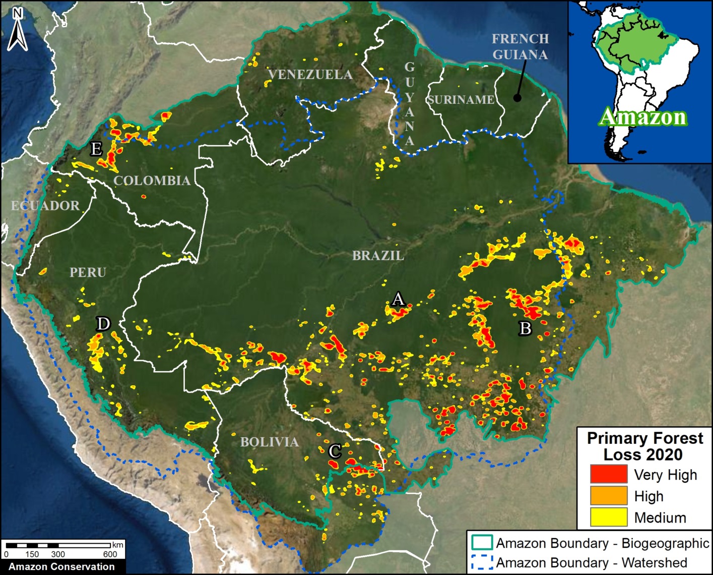
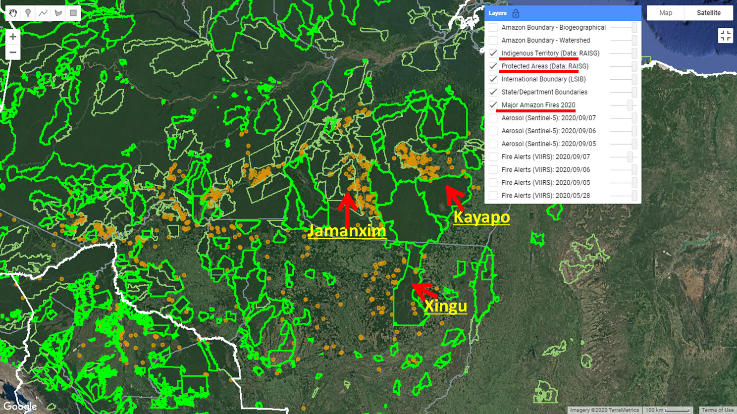
Last year (2020), we demonstrated the power of our real-time Amazon fire monitoring app (see MAAP #118 and MAAP #129).
In a novel approach, the app uniquely combines data from the atmosphere (aerosol emissions in smoke) and the ground (heat anomaly alerts) to quickly and precisely detect major Amazon fires.*
Using the app, we just detected the first two major fires in the Brazilian Amazon for 2021.
These fires occurred on May 19 and 20, respectively, both on the southern edge of the Amazon in the state of Mato Grosso. For comparison, last year’s intense fire season started on May 28.
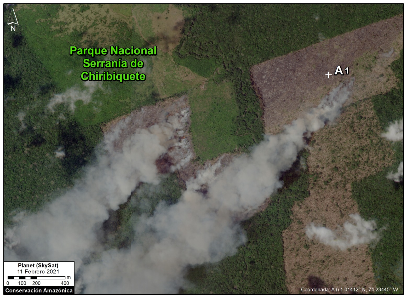
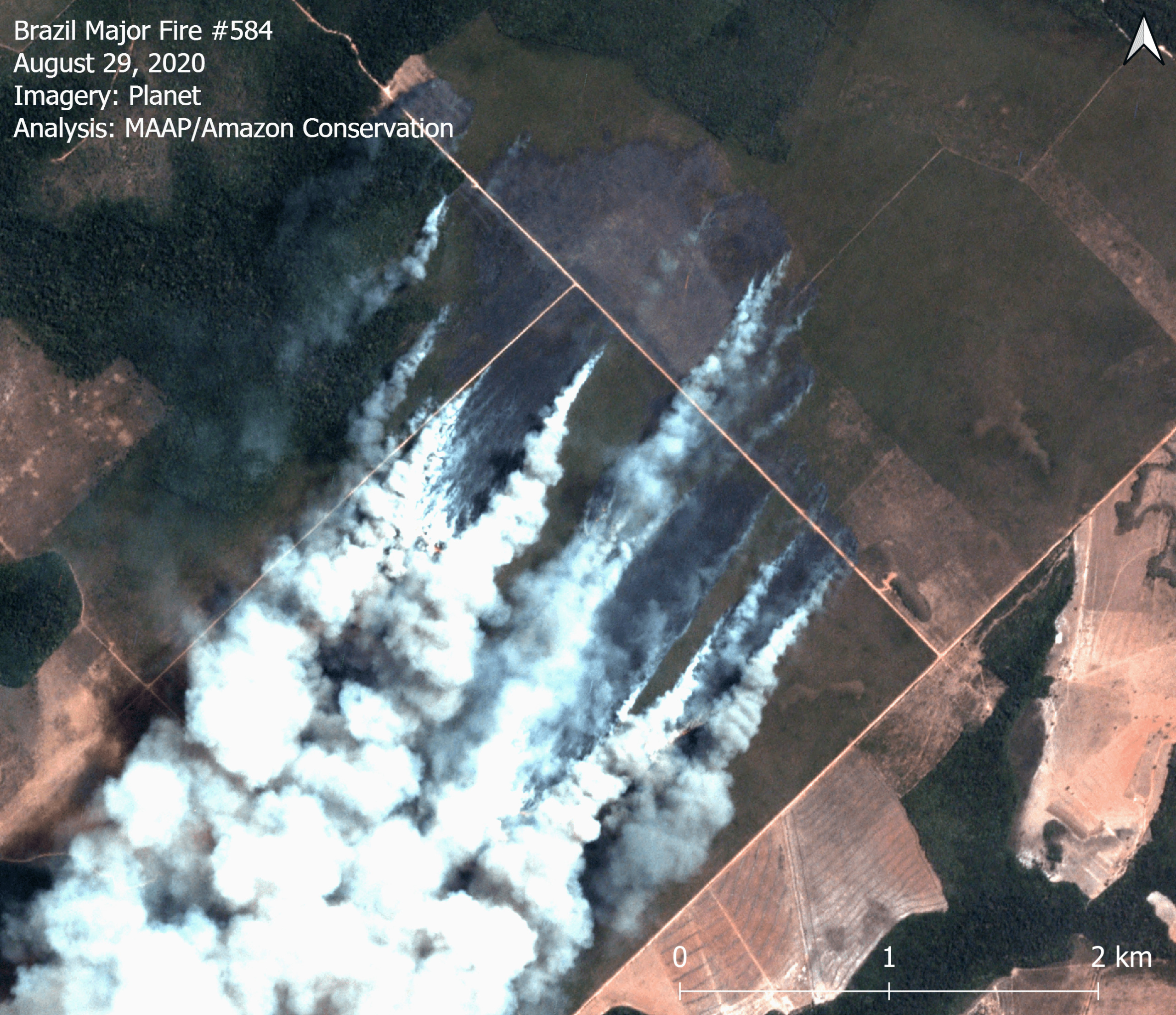
We confirmed both fires using high-resolution imagery from the satellite company Planet.
Importantly, the imagery also revealed that both fires burned recently deforested areas. That is, instead of being actual “forest fires,” both areas were actually first deforested in 2020 and then burned in 2021. See MAAP #113 for background on this important point.
Below, we show a striking series of satellite imagery videos showing this critical process of Amazon deforestation followed by Amazon fires.
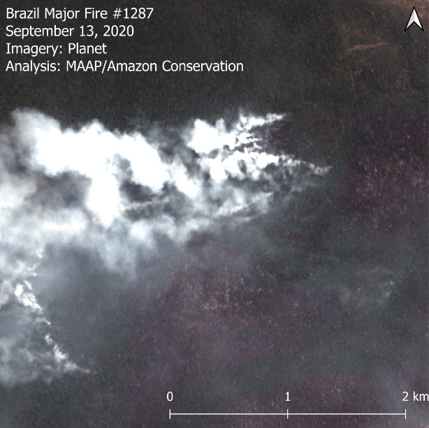
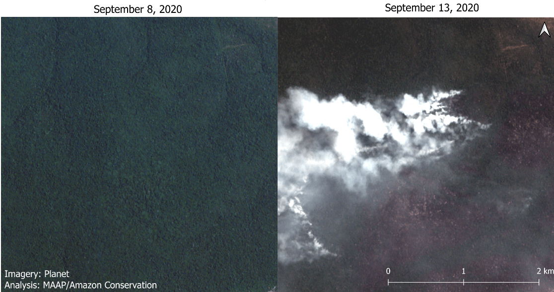
2021 Brazilian Amazon Fire #1
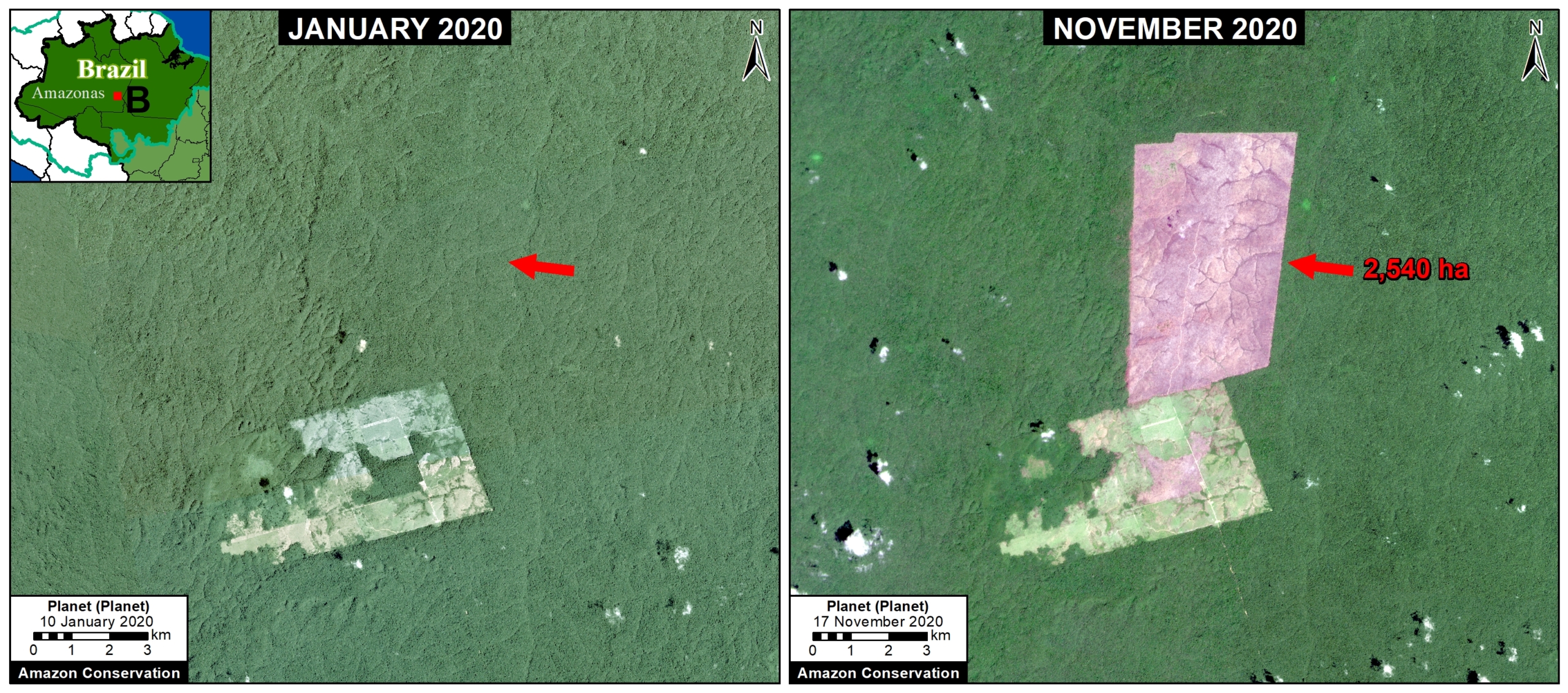
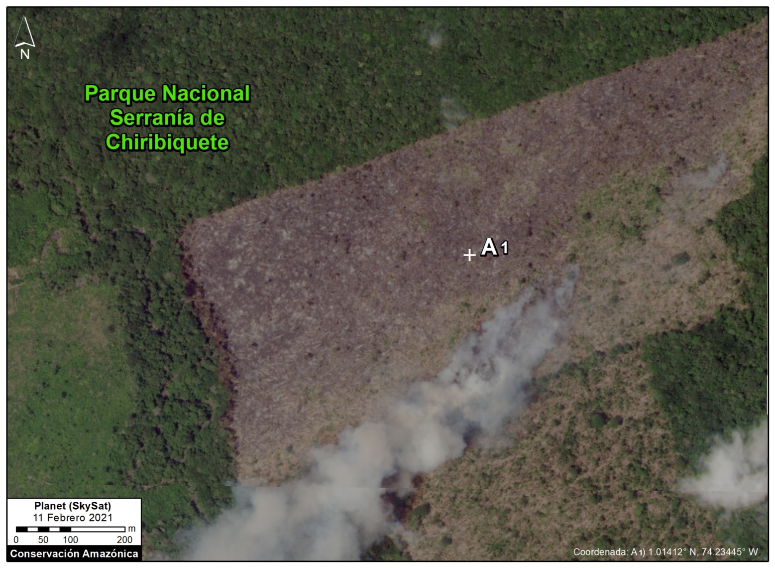
We detected the first major fire of the year in the Brazilian Amazon on May 19, on the southern edge of the Amazon in the state of Mato Grosso. As the satellite video shows, this area was first cleared in 2020 and then later burned in 2021.
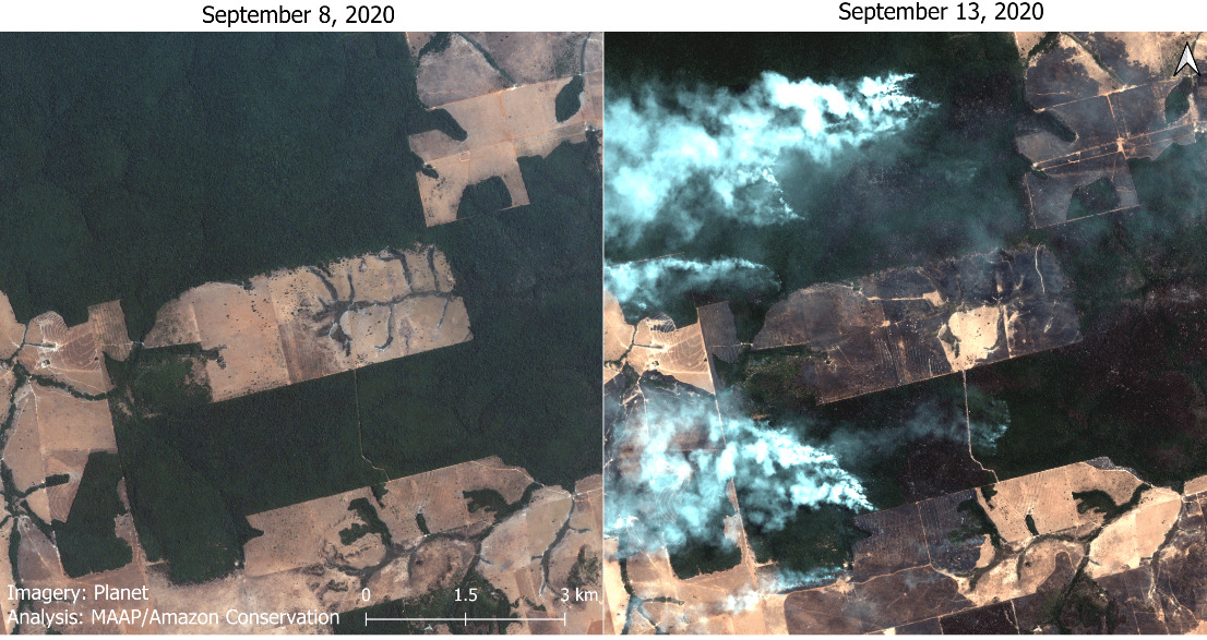
2021 Brazilian Amazon Fire #2
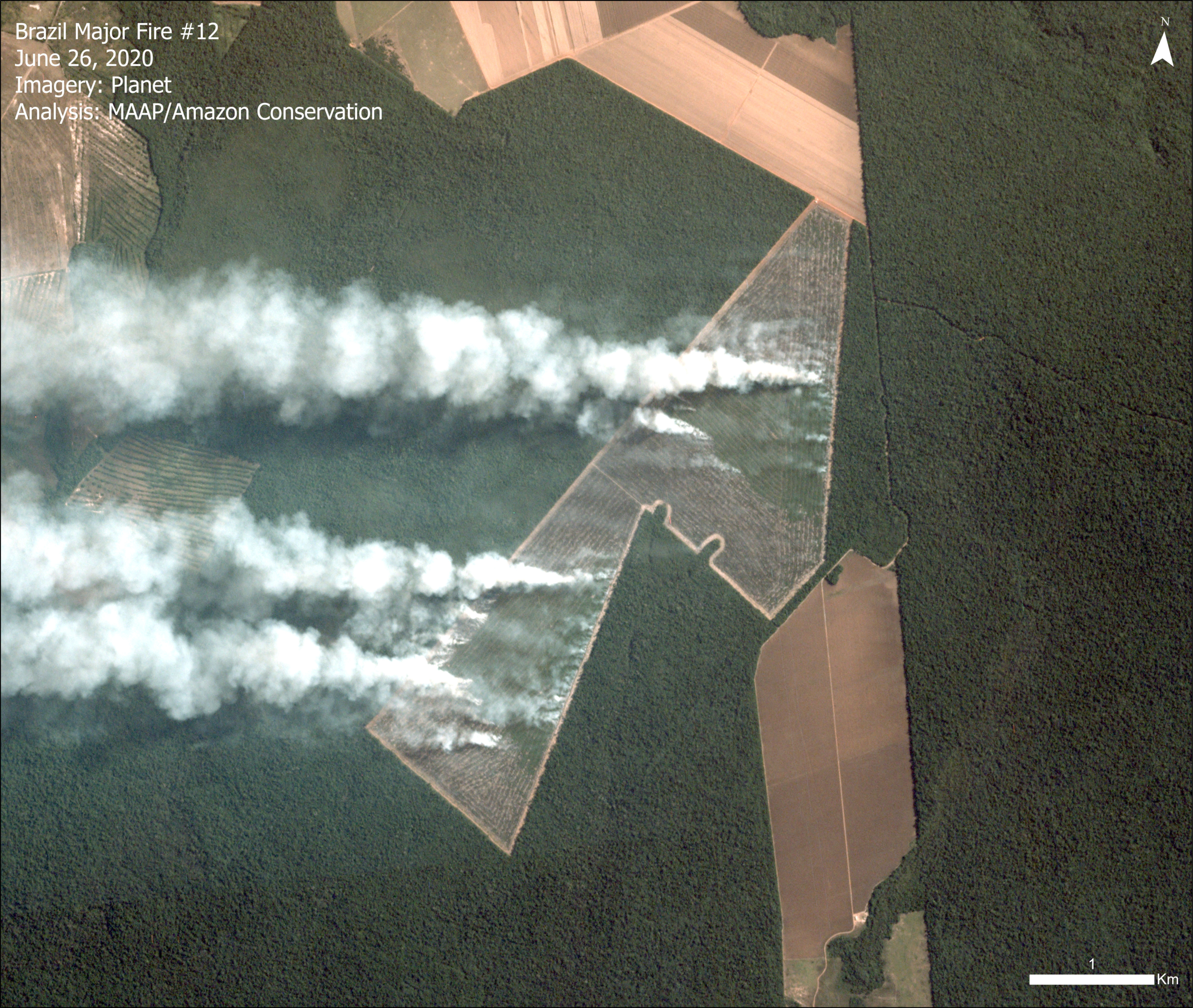
We detected the second major fire of the year in the Brazilian Amazon the following day, on May 20, also on the southern edge of the Amazon in the state of Mato Grosso. As the satellite video shows, this area was also first cleared in 2020 and then later burned in 2021.
*App Background
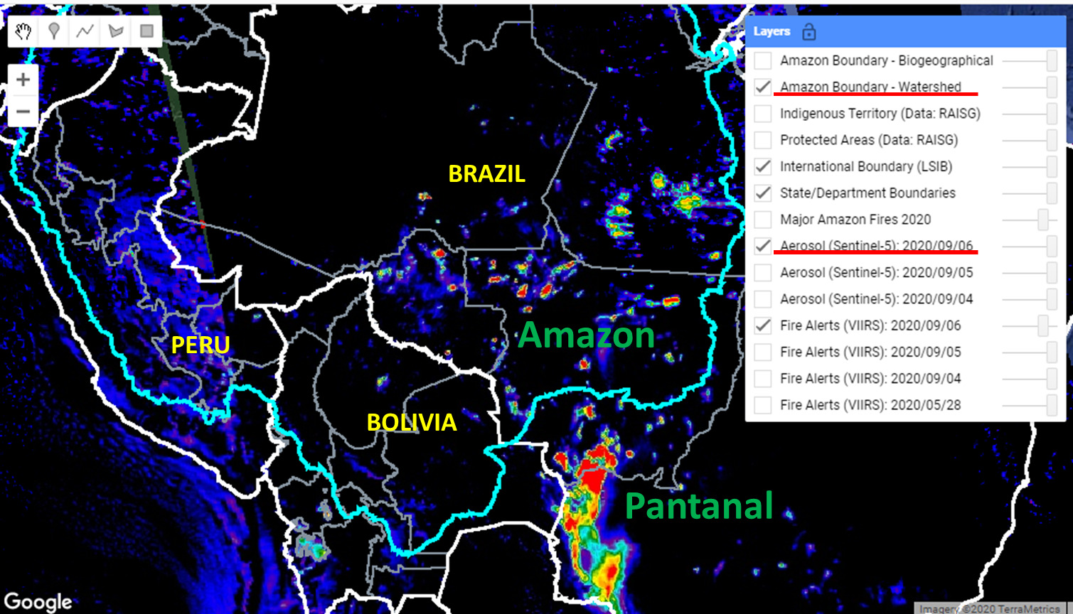
We launched a new and improved version of the Amazon real-time fire monitoring app in May 2021. The app is hosted by Google Earth Engine and updated every day by the organization Conservación Amazónica, based in Peru.
The app displays aerosol emissions as detected by the European Space Agency’s Sentinel-5 satellite. Elevated aerosol levels indicate the burning of large amounts of biomass, defined here as a “major fire”. In a novel approach, the app combines data from the atmosphere (aerosol emissions in smoke) and the ground (heat anomaly alerts) to effectively detect and visualize major Amazon fires.
When fires burn, they emit gases and aerosols. A new satellite (Sentinel-5P from the European Space Agency) detects these aerosol emissions (aerosol definition: Suspension of fine solid particles or liquid droplets in air or another gas). Thus, the major feature of the app is detecting elevated aerosol emissions which in turn indicate the burning of large amounts of biomass. For example, the app distinguishes small fires clearing old fields (and burning little biomass) from larger fires burning recently deforested areas or standing forest (and burning lots of biomass). The spatial resolution of the aerosol data is 7.5 sq km. The high values in the aerosol indices (AI) may also be due to other reasons such as emissions of volcanic ash or desert dust so it is important to cross reference elevated emissions with heat data and optical imagery.
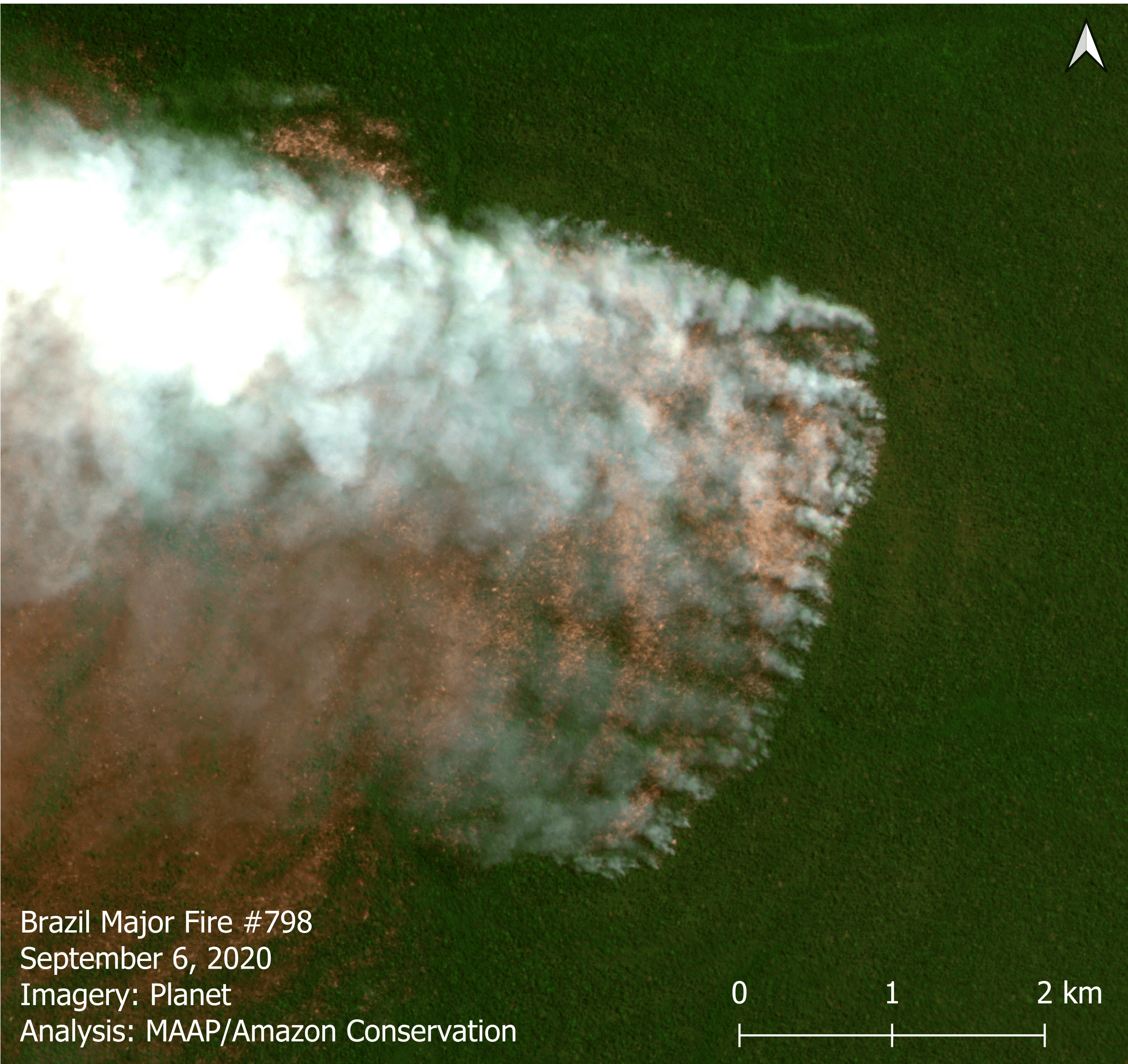
We define “major fire” as one showing elevated aerosol emission levels on the app, thus indicating the burning of elevated levels of biomass. This typically translates to an aerosol index of >1 (or cyan-green to red on the app). To identify the exact source of the elevated emissions, we reduce the intensity of aerosol data in order to see the underlying terrestrial heat-based fire alerts. Typically for major fires, there is a large cluster of alerts. The major fires are then confirmed, and burn areas estimated, using high-resolution satellite imagery from Planet Explorer.
Since the data updates daily and is not impacted by clouds, real-time monitoring really is possible. Our goal is to upload each day’s new image in the late afternoon/early evening.
Acknowledgements
The app was developed and updated daily by Conservación Amazónica (ACCA). The data analysis is led by Amazon Conservation in collaboration with SERVIR Amazonia.
This work was mainly supported by NORAD (Norwegian Agency for Development Cooperation) and ICFC (International Conservation Fund of Canada).
Citation
Finer M, Villa L (2021) Amazon Fire Tracker 2021: Brazilian Amazon Fire Season Begins. MAAP.